SELECTED ALTERNATIVE
(POSTED JANUARY 2026)
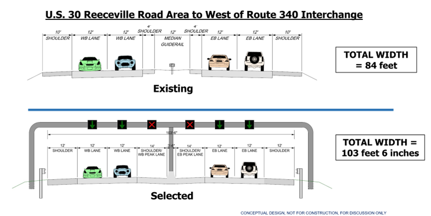
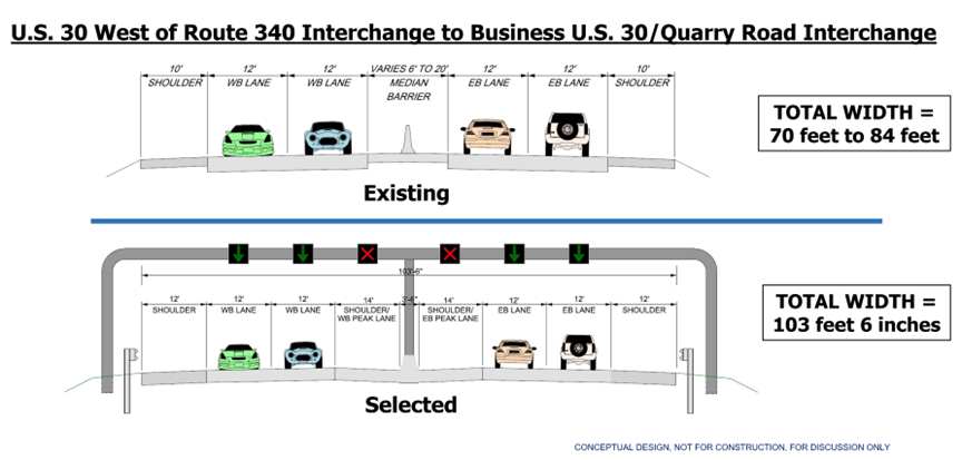
The results of the conceptual engineering evaluation and the feedback from stakeholders and the public have been reviewed, and an alternative has been selected for the U.S. 30 Mainline and Business U.S. 30/Quarry Road Interchange. The U.S. 30 Mainline flexible use lanes have been selected to proceed to Preliminary Engineering. The flexible use lane along U.S. 30 Mainline Westbound will begin at the U.S. 30 westbound on-ramp from Business U.S. 30, and the flexible use lane along U.S. 30 Mainline Eastbound will end at the U.S. 30 eastbound off-ramp to Quarry Road.
It is anticipated that on a typical weekday, the eastbound flexible use lane will be open during the weekday morning peak commuter hours and the westbound flexible use lane will be open during the weekday afternoon peak commuter hours. The PennDOT Traffic Management Center will manage the flexible use lanes through control of the overhead signs and message boards in the area. The areas will be inspected to ensure the pavement is clear of debris before opening the lanes. Information will be prepared to educate the public before the flexible use lanes are opened to traffic. Through connections between PennDOT and various interactive map applications like Waze and Google, these services will be able to relay information about the availability of the flexible use lanes in real time.
Since the PennDOT Traffic Management Center will control the flexible use lanes, operators will be able to open the lanes at other times when needed for incidents on U.S. 30 or for incidents on other roadways resulting in increased traffic on U.S. 30. When the flexible use lanes are closed, the overhead signage above the lane will show a red “X”, indicating the lane is closed.
Additional public meetings will be held in the future, as additional details are available.
In December 2021 through February 2022, an online virtual experience was hosted to present the conceptual design work and alternatives for the Eastern Project Area (Section CER), from just west of the Reeceville Road interchange to the Quarry Road / Business U.S. 30 interchange for public input. The information presented at that time can be viewed here.
U.S. 30 MAINLINE SELECTED ALTERNATIVE
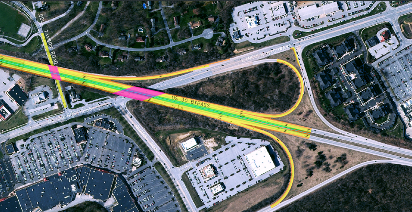
BUSINESS U.S. 30 & QUARRY ROAD INTERCHANGE SELECTED ALTERNATIVE
ENVIRONMENTAL RESOURCES
The limited size of the study area for this section includes a small number of significant environmental features. The township-owned Bell Tavern Park lies north of U.S. 30 at the western limits of the section. One wetland is present along the north side of U.S. 30 within Bell Tavern Park. An unnamed tributary to the East Branch of Brandywine Creek runs through the eastern edge of the park and under U.S. 30. Two additional unnamed tributaries to the creek are situated between Quarry Road and Business U.S. 30.