SELECTED ALTERNATIVE
(POSTED JANUARY 2026)
The results of the conceptual engineering evaluation and the feedback from stakeholders and the public have been reviewed, and an alternative has been selected for the Reeceville Road Interchange. Alternative B – Traditional Diamond Interchange centered on Reeceville Road with realignment of Fisherville Road (as presented in the December 2021 through February 2022 online virtual public involvement process) has been selected to proceed to Preliminary Engineering. Additional public meetings will be held in the future, as the interchange design is completed and additional details are available.
In December 2021 through February 2022, an online virtual experience was hosted to present the conceptual design work and alternatives for the Eastern Project Area (Section CER), from just west of the Reeceville Road interchange to the Quarry Road / Business U.S. 30 interchange for public input. The information presented at that time can be viewed here.
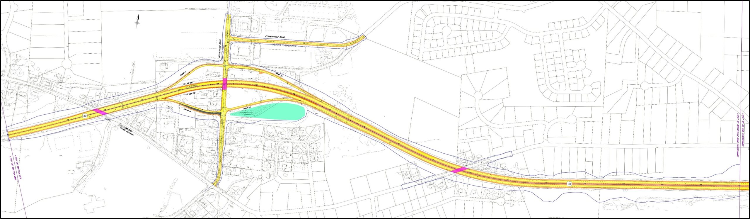
REECEVILLE ROAD AREA OVERVIEW MAP
REECEVILLE ROAD INTERCHANGE SELECTED ALTERNATIVE
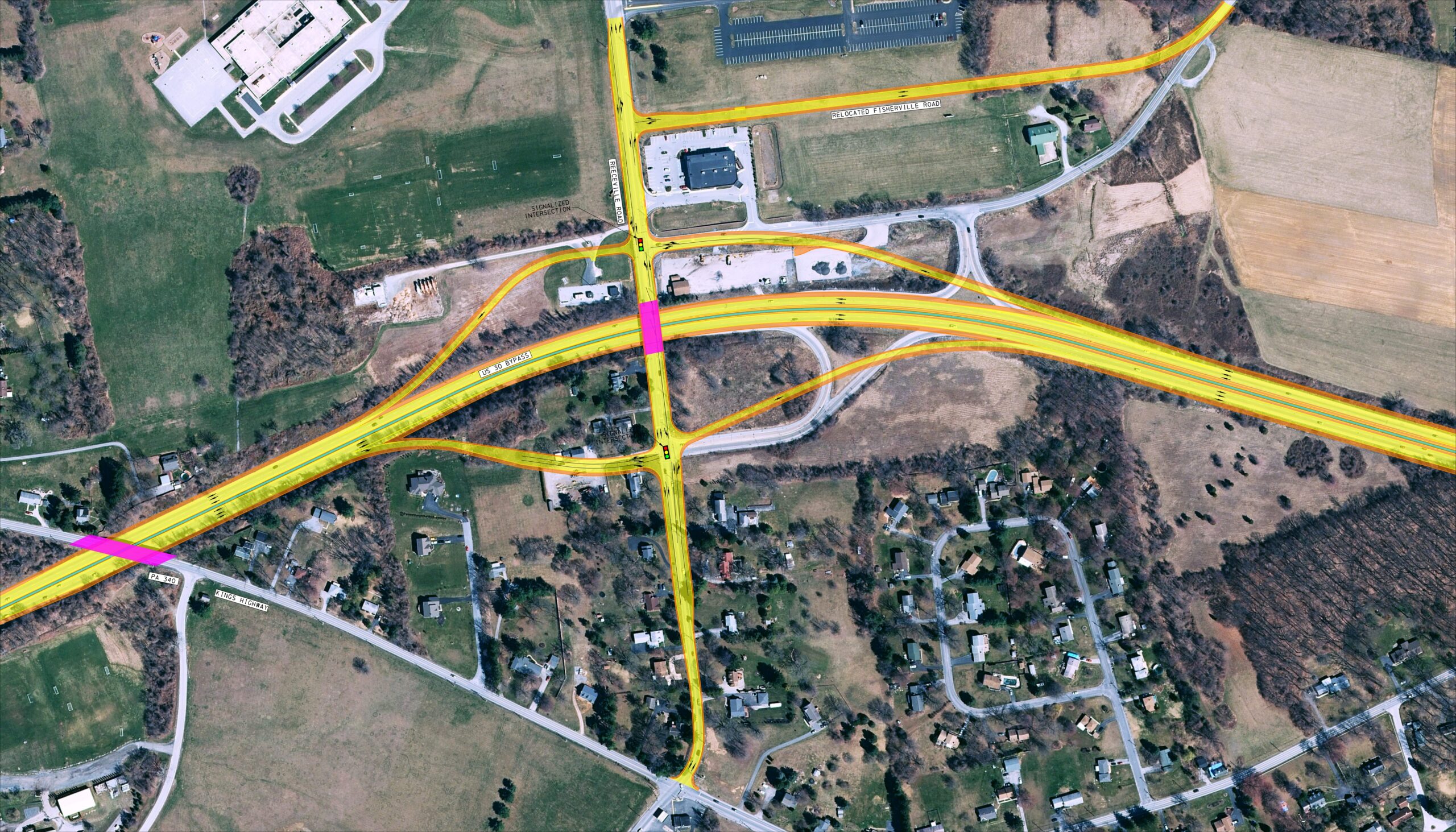
- Full Diamond Interchange at Reeceville Road to replace the existing interchange.
- Fisherville Road will be relocated to the north between the CVS and the Wawa. Fisherville Road will be stop controlled at Reeceville Road.
- The U.S. 30 eastbound and westbound ramp intersections with Reeceville Road will be signalized.
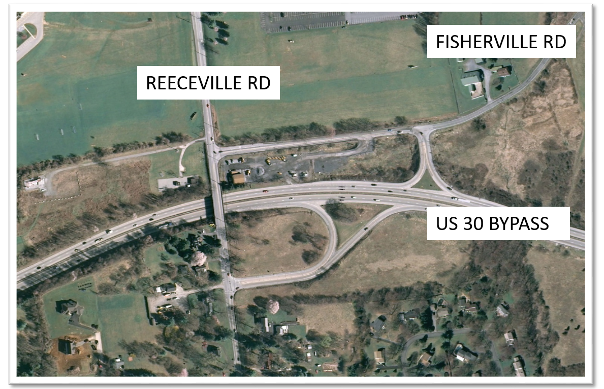
EXISTING CONDITIONS
The existing interchange of US 30 and Reeceville Road provides both eastbound and westbound on-ramps and off-ramps. The westbound on-ramp and off-ramp intersect Fisherville Road. The eastbound on-ramp and off-ramp intersect Reeceville Road. The existing intersection of Reeceville Road and Fisherville Road is a signalized intersection.
EXISTING CONDITIONS
ENVIRONMENTAL RESOURCES
Some of the significant environmental features of the section include farmland, historic properties, a park, a golf course, schools, a hospital, ten streams, and three wetlands. Three active agricultural parcels are present in the vicinity of Fisherville Road; however, development of two parcels is planned, and the third is within the former Brandywine Hospital medical complex. Two properties within the section are known to be of historical significance; the Coatesville VA Medical Center, which is a National Register of Historic Places (NRHP) listed property located south of U.S. 30, and the North Brandywine Middle School, which is a NRHP eligible resource located north of U.S. 30. Two schools, the North Brandywine Middle School and the Reeceville Elementary School, are located on the same property within the section. Caln Park West township park and its athletic fields lie within the western limits of the section on the south side of U.S. 30. The Ingleside Golf Club is also located south of U.S. 30 at the eastern limits of the section. The wetlands in the section lie on the east side of the Reeceville Road interchange on both sides of U.S. 30, and at the western limit of the section on the south side of U.S. 30. Four small headwater channels, tributaries to Beaver Creek, are associated with the eastern wetlands. Three more small, headwater channels of Beaver Creek are situated within the woods of home owner’s association open space just west of the golf course. Another three small channels adjacent to the western wetland are tributaries of West Branch Brandywine Creek.